

Sensors to be installed off Hull’s coastline to collect data, monitor sea-level rise
/By Dolores Sauca Lorusso
On Tuesday night, the Hull Conservation Commission gave a unanimous green light to the Woods Hole Oceanographic Institution’s (WHOI) Request for Determination of Applicability (RDA) to install water sensors in various locations along Hull’s coastline to monitor sea level rise.
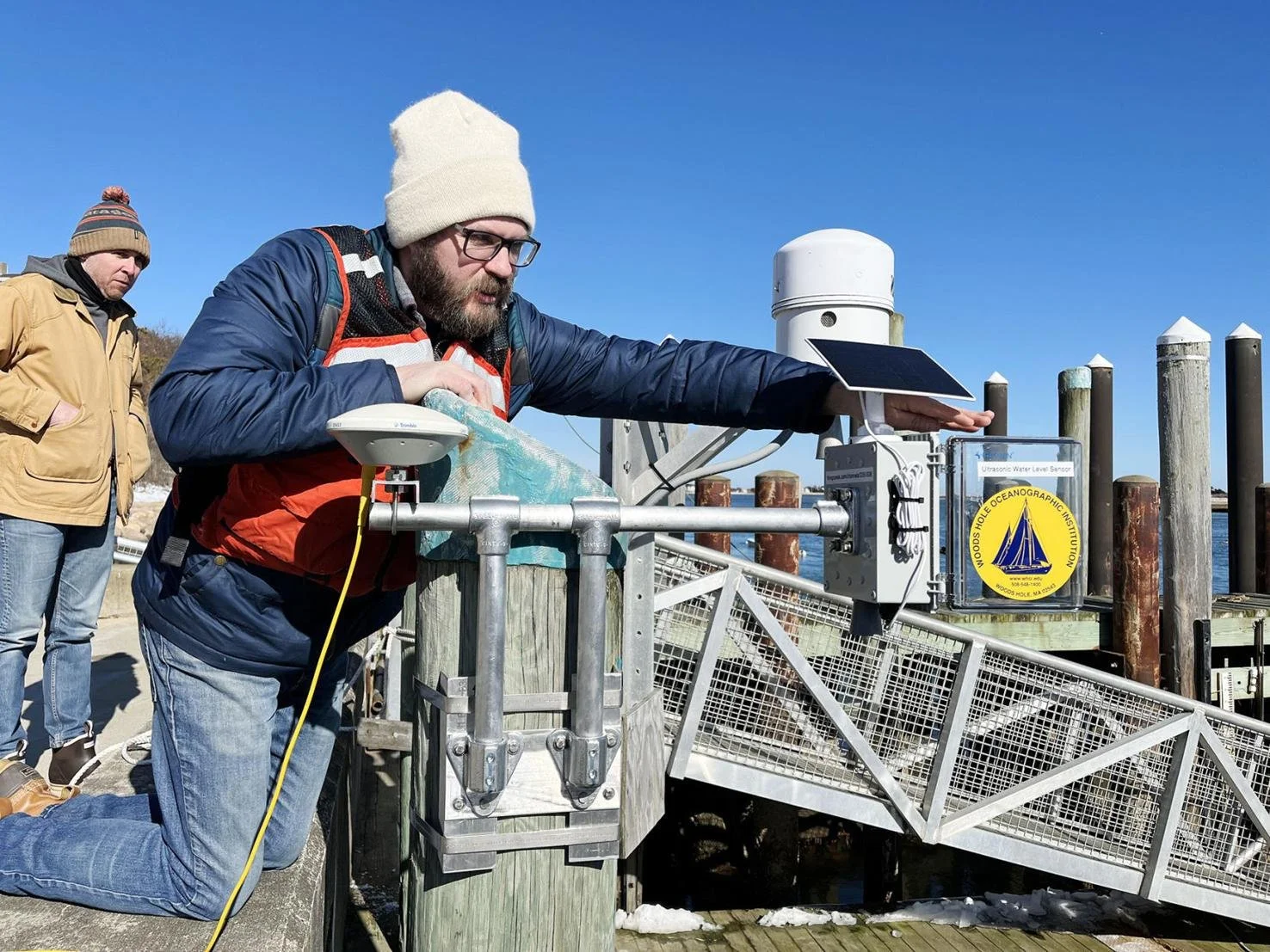
In this image from the Woods hole oceanographic institute’s website, research Associate Levi Gorrell opens the panel door of a water level sensor being deployed in chatham; similar sensors are proposed for installation off hull’s coastline.
The WHOI identified Hull as well suited to test the water sensors because the coastal community is vulnerable and provides an opportunity to better understand local flooding problems.
Sarah Das, WHOI scientist and author of the RDA, said a team at WHOI worked to develop the low-cost water level sensors to determine how sea level rise is affecting us “right in our back yard.”
The water level sensors are expected to help scientists track sea level rise in coastal communities throughout Massachusetts and the WHOI kept the cost low, about $300 per prototype.
WHOI has already deployed the new devices at its Woods Hole dock as well as Chatham Fish Pier. The WHOI visited Hull in April and is working with Chris Krahforst, Hull’s director of climate adaptation and conservation, to identify areas in Hull for placement of the sensors.
The commission members did not see any adverse effects of putting the sensors in place.
The sensors consist of a plastic box about the size of a tissue box that contains the electronics. On the top is a solar panel for power; on the bottom is an acoustic transducer, which is shaped like a small cone. A transducer converts acoustic energy to electrical energy and vice versa.
WHOI scientists believe the water-level sensors will provide data to a greater number of coastal communities and add community-specific data to the NOAA existing tide gauge network, which covers only a small portion of the Massachusetts coast.
According to Das, having the sensors in town will fill in some of the holes between someone reporting a flood in their backyard and the NOAA existing tide gauge not connecting to what the community is experiencing.
“There are only a handful of tide gauges on the whole Northeast, with an enormous stretch between observation areas,” Das said. “We need to deploy more sensors to understand water levels at a much finer scale.”
WHOI understands even a small community can see variability; it may not be a significant storm event, but it produces flooding.
NOAA’s tide gauges measure water levels every six minutes. There are six NOAA tide gauges in Massachusetts: in Woods Hole, Nantucket, Chatham, New Bedford, Fall River, and Boston.
The WHOI sensor uses technology similar to sonar to make its measurements; by sending out short pulses of sound and measuring how long it takes those sound waves to reach the surface of the water, scientists can determine the water level.
According to WHOI, the sensor collects data for 30 seconds every 10 minutes. Every second that the sensor is collecting data, it takes six distance measurements. Every 10 minutes, the collected data is averaged into one number that is sent to the cloud using a cellular data modem.
WHOI would like to deploy water sensors in Hull so scientists can compare the prototype to NOAA’s Chatham tide gauge across a wide variety of weather and water conditions.
According to a WHOI press release, sea level has risen in Massachusetts by two to three inches since 2022, “which is much faster than average rates observed over the previous three decades.” According to WHOI physical oceanographer Christopher G. Piecuch, this number comes from measurements taken by the Woods Hole and Nantucket tide gauges.
Das said it is this uneven accelerated rate of change, when it comes to sea level rise, that prompts a need for more data collection, especially to learn how that increasing rate will affect flooding on a local scale.
The sensors will assist in empowering coastal communities with localized data that could be used to mitigate flood risk.
“Where are we experiencing problems? Where might we want more data? How does a rainfall event come in versus extra river runoff, versus winds coming from the east or the west? All these scientific questions which really build into communities understanding why they’re having flooding in certain places and why it’s changing,” said Das.
Das pointed out during the same weather event, there could be a flood in one Hull neighborhood but not in another. The water sensors will provide detail that isn’t really captured by the federal network, which only monitors sea-level rise along a small amount of the state’s coastline.
In addition, Das said researchers have good measurements for sea level rise, but they don’t have as much data for coastal flood events. Researchers are hopeful the sensors will improve understanding of flood processes, as well as the models used to allocate resources going forward.
“What we imagine for the future are networks of coastal water sensors that provide coastal towns and cities with data to inform policy and response,” said Das. “That helps scientists validate coastal flood risk models and advance our understanding of coastal flooding more generally.”
Like what you’re reading? Stay informed with a Hull Times subscription by clicking here.
Do you have an opinion on this issue? Click here to write a Letter to the Editor.


